- You cannot add another "Views in Third Congressional District - Schori & Lehmann Brewery in Elgin, Court House in West Union and Residence of Hon. P.G. Baily in Grand Meadow" to your cart. View cart
 |
||
Washington
In stock
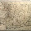
Rand McNally made this “Commercial Atlas of America” in 1920. Washington is illustrated on this large, very detailed map. Counties, cities, towns, churches, important land forms, train stations, railroad lines, major roads, post offices and telegraph stations are all identified. Each existing railroad route is mapped and stations are identified by a number which corresponds to a key providing its name. Some distances and common sea routes are shown between points on the coast and various other locations. The populations of principal cities are provided in the margin.
Size: 25.5 x 19 inches
Condition: Very Good-age toning
Map Maker: Rand McNally
Coloring: Printed color
Year: 1920
Condition: Very Good-age toning
Map Maker: Rand McNally
Coloring: Printed color
Year: 1920
In stock