- You cannot add another "Views in Third Congressional District - Schori & Lehmann Brewery in Elgin, Court House in West Union and Residence of Hon. P.G. Baily in Grand Meadow" to your cart. View cart
 |
||
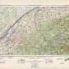
Brockville – Ogdensburg, Canada and Eastern United States
In stock
Produced by the Department of National Defense, Canada, and the Army Survey in 1952, this topographic map indicates wooded areas, marshes or swamps, eskers, streams, and lakes. Other indications may include roads, trails, mines, and survey monuments. This map of Brockville-Ogdensburg, with part of Canada and Eastern United States includes hard surface roads, loose roads, wagon tracks, railways, and boundary lines. There is a library stamp and markings in margin.
Size: 25.75 x 18.25 inches
Condition: Very Good
Map Maker: Department of National Defense - Canada
Coloring: Printed Color
Year: 1952
Condition: Very Good
Map Maker: Department of National Defense - Canada
Coloring: Printed Color
Year: 1952
In stock